
Maps, Annotated: The World’s 300 Greatest Maps Explained (ISBN 9780241682845) is an illustrated journey through the history of mapmaking, featuring more than 300 celebrated maps, from ancient star charts and Babylonian world views to the Aztec map of Tenochtitlán and the modern Gaia map of the Milky Way.
Luped® Media Research sourced over 1,000 images from more than a hundred libraries, museums, map dealers, and photographic agencies worldwide, licensing 800 for inclusion in the final book. Produced on high quality paper, the printed edition displays these images with impressive clarity.
To explore this publication further, visit the publisher’s website here.
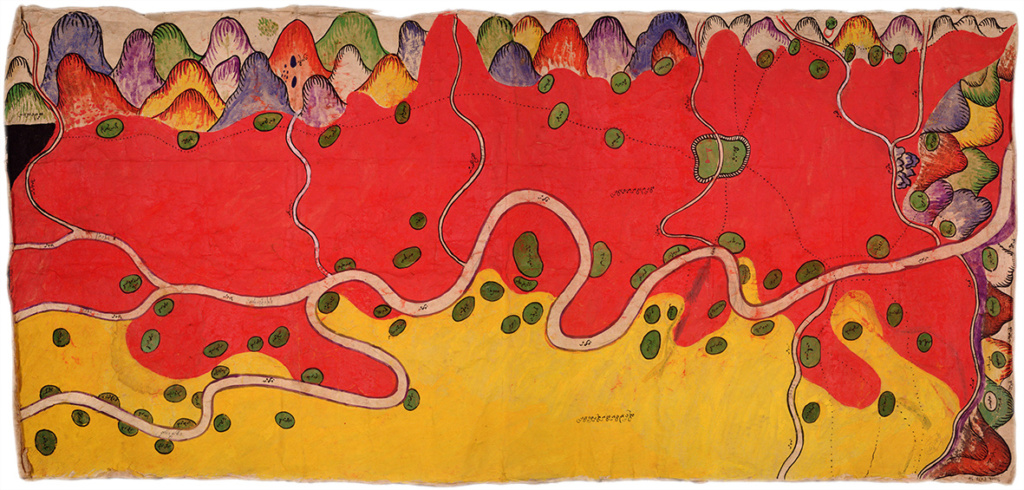
Shan borderlands: 1889 map from the Scott Collection details the Burma-China frontier dispute, showing Chinese territory, British-tributary Shan states, and around 80 villages along the Nam Mao (Shweli) River. Credit: MS Scott LR13.34, Cambridge University Library